Flood Alleviation within Rural Development
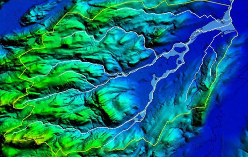
Posted: January 8, 2015 Filed under: Uncategorized Leave a commentThis gallery of images records a 2014 survey of FRM/’ALFA’ potential along the rural England-Wales border. Evidence exists there of opportunities, primarily by attenuation, to exploit CAP Pillar 2 incentive for community FRM investment by Adaptive Landuse (Ecosystem Service). Approaching 100 locations of interest are identified. Such sites, when characterized, should be visible also to spatial targeting software.
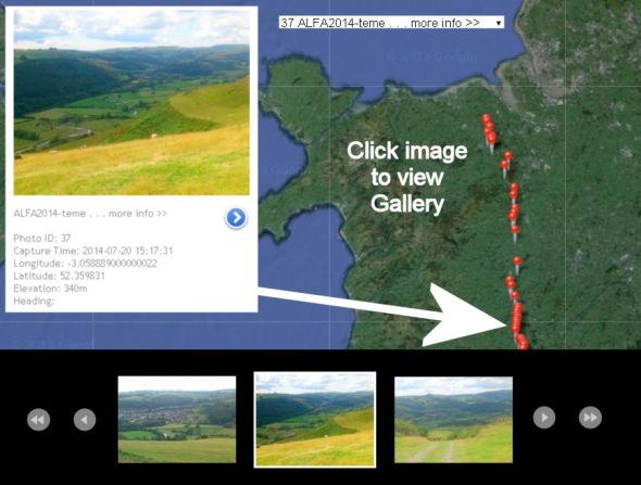
Character (photo-tag) updates are in progress by
- agristructure_opportunity (porous structural features)
- downstream_risk
- floodplain_opportunity
- green_storage
- infrastructure_opportunity
- landuse_risk
- pinch_point
- roughness_opportunity
Keywords:
SCIMAP, Atrepo, Offa, Alfa, Flooding, NFM, Opportunity mapping, Connectivity mapping, Risk Mapping
– – – – – – ‘ALFA’ acronym courtesy EU/NERC projects – – – – – –
(‘more info >>’ points currently to Atrepo archive)
test embed from box public