What is RAS-Flood
RAS-Flood is an assembly of three complementary generic software utilities which map and assess, by virtual case study, ‘in-channel’ OWC catchment solutions to fluvial flooding :-
- Routine GIS feature-creation from Lidar point-cloud to describe the catchment digitally (Globalmapper being hard to beat)
- Moderated pragmatic stream Bathymetry to 1M grid from stage 1 (Atrepo point-smoothing methodology being critical to bed-interpolation)
- 2D Terrain-Mesh creation and channel-flow computation (HECRAS 5-2D courtesy USACE)


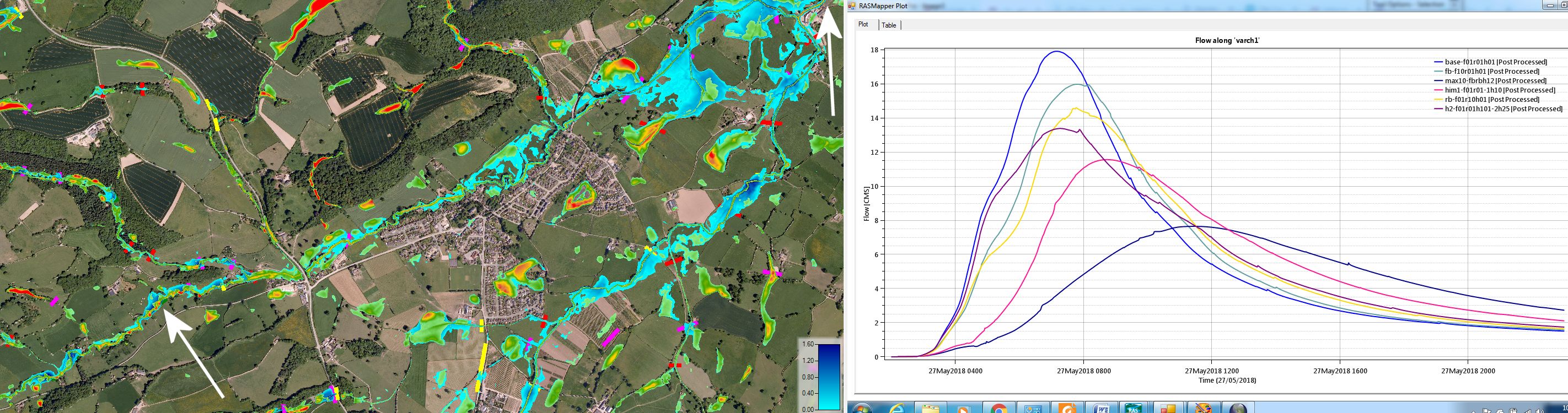
In this way, alternative channel features can be tested in software against extreme rainfall set as calibrated input to the 2D hydraulic model.
Q1:
How long does it take to produce indicative hydrographs from catchment rainfall (for comparison of alternative intervention and landuse measures) ?
Allow a day per 10 sq km for stage-1 (2.5 GHz x 8GB hardware) and 15 minutes per stream for stage-2. Stage-3 mesh creation within the GIS perimeter and with breaklines from stage-1 is automated and takes only a few minutes. However allow an hour or so to check over terrain-geometry manually.
Then, with terrain-geometry, bathymetry & (initially say) 24 hour rainfall loaded, hydraulic flow to yield indicative hydrographs can be tested in less than an hour (per 100 sq km). A cloud server, running the flow analysis code more quickly, is available on request (email gaw1@cantab.net)
Q2:
Will catchment flood alleviation measures be considered by policy-makers to provide ‘public good’ and thereby eligible for ‘public funds’ ?
Hard to say, but there is talk of the 2018 Agriculture Act putting a solid value per cubic metre of ‘blue-green’ extreme-event flood-water-storage. (In 2015, the Eden catchment required additional catchment storage in the region of 20,000,000 cubic metres – ie approx 10,000 cubic metres per square kilometre of catchment.)
Q3:
What does ‘RAS-Flood’ cost and is there a limit to catchment size ?
Data and code are free to download – thereby to provide a steer on stream bathymetry and hydraulic flow. No size limit – useful results to date from 2 sqkm to 1000 sqkm catchments
————————————————-
RAS-Flood Methodology More on Virtual Case Study Acknowledgements
![]()
————————————————-
Download tests: canal map g40-fbridges
