Upper Severn ‘blue-green’ analysis – Q10 calibration 1Dec2015
Posted: December 15, 2015 Filed under: Uncategorized Leave a commentThis gallery of images records a 2015 survey of ‘Blue-Green’ (ALFA) potential in the Severn Uplands.
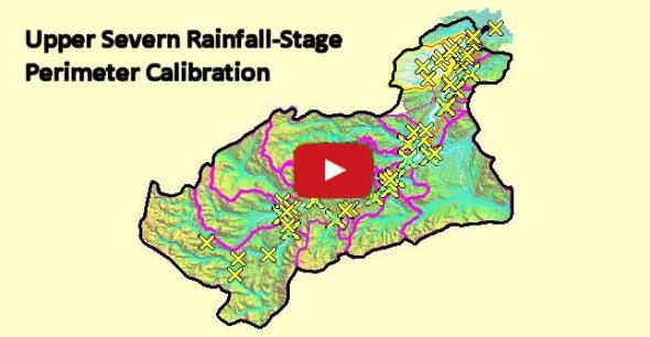
The approach is to map opportunity for green storage thereby to exploit CAP Pillar 2 incentive for community FRM investment in Adaptive Landuse (aka Ecosystem Service). Flood extent at some 50 points on the wet perimeter of a c. Q10 event is mapped following 35mm rainfall over 36 hours on 29/30 Nov 2015
Keywords:
SCIMAP, Atrepo, Alfa, Flooding, NFM, Opportunity mapping, Blue-Green
![]()
Acknowledgements – (‘ALFA’ acronym courtesy EU/NERC projects)
